


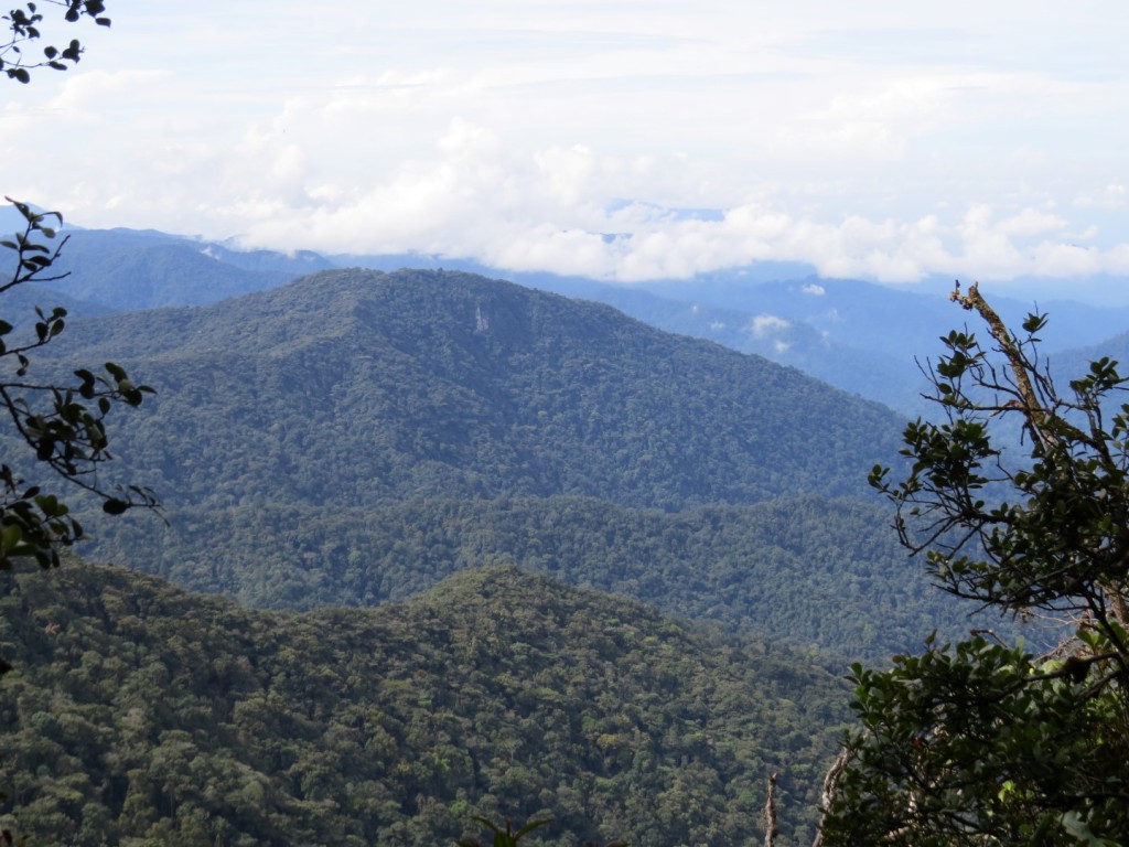


REACH4Birds – Introduction to Montane Birds of Cameron Highlands
18 September 2014. – REACH conducted an “Introduction to The Montane Birds Cameron Highlands in the last school holidays. The turn out and eager participation from the young children in our community was encouraging.
The session began with a sneak preview of our bird book, Montane Birds of Cameron Highlands. The pictures in the book truly excited the participants when they were shown some of the beautiful common birds which could be found in our gardens.
After a briefing on Birding Etiquette & Ethics – do’s and don’ts. We proceed to learn how to ID a bird in the field using quick and simple sketches. Armed with a notebook and pencil we headed up to the Convent and started our outdoor session of ID the birds in the field.
Join us for our Birdwatching Workshop – Practical Session 1
(follow up for those who attended the first session. New participants welcome too)
Introduction to The Montane Birds Cameron Highlands
Date : 6 Oct 2014 (Monday)
Time : 9 am – 11 am
Venue : No.100 Camellia 2, Tanah Rata (row of houses beside Parkview)
Costs : free REACH Members / RM15 non-members (so best sign up as a member)
Places limited to 20 pax.
The Weather Stations of Cameron Highlands
 17th September 2014-
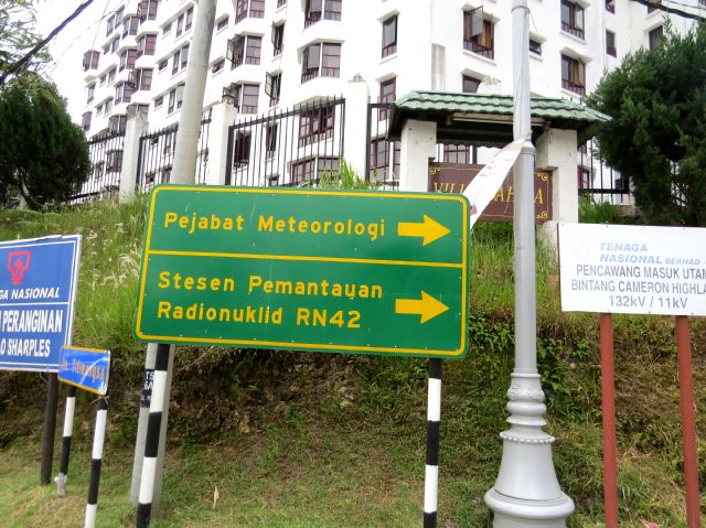
The location of our current weather station at Jalan Tengkolok ,Tanah Rata is known to many locals, so when the above signboard came up, many amongst us did not bat an eyelid. I certainly did not, despite passing by this notice almost daily as I commute between Tanah Rata and Brinchang. That is until a close friend told me its significance and I decided to google it. What I found was very interesting indeed.
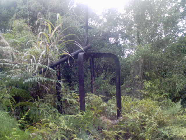 Sometime in early 2008, a mast like structure was found in Rhododendron Hill in Tanah Rata which turned out to be an anemometer (device used to measure wind) mast. The feedback from some senior residents was that in the 1930’s a weather station was built there by the British to monitor the climate for the then budding tea industry. Parameters measured included wind and temperature.

 In 1935 the Meteorological department built a weather station on the hill behind the main street of Tanah Rata at latitude 4”28’ North and 101” 23’ East and elevation of 1471 metres above sea level. Most of our earlier meteorological data were from this station which is operational till today. Initially it was used to measure basic climate monitoring parameters such as temperature, rainfall, wind direction and speed etc. In 2012 seismic ‘strong motion’ detectors were installed. To put it simply, if the ground beneath us in Cameron Highlands were to do the ‘shakes’ it would be able to detect it. This little station of ours has become an earthquake monitoring station.

 In the earlier 1980’s most of the basic observations were shifted to a new station located at 4 “ 47’North and 101”37’ East at an elevation of 1545 MSL. This new site was chosen because it was a little further away from major developments and the surrounding areas pristine with acres upon acres of lush montane forest. The pristine nature of the environment would ensure more accurate climate readings and in 1989 this new station became a Baseline Global Atmospheric Watch GAW station. Subsequently in 2004 it became the Regional GAW station, a testament perhaps that our environment in these parts is relatively uncontaminated for now.

In 2008, following the signing of the Comprehensive Nuclear Test Ban Treaty and with the cooperation of the Malaysian Meteorological Department, the Malaysian Nuclear Agency and the Preparatory Commission for the Comprehensive Nuclear Test Ban Treaty Organisation CTBTO, this little station became a Radio nuclide monitoring station.Hence the above signboard.
(The Comprehensive Nuclear-Test-Ban Treaty (CTBT) bans nuclear explosions by everyone, everywhere: on the Earth’s surface, in the atmosphere, underwater and underground. One hundred and eighty three countries have signed the Treaty, of which 163 have also ratified it (as of September 2014), including three of the nuclear weapon States: France, the Russian Federation and the United Kingdom. But 44 specific nuclear technology holder countries must sign and ratify before the CTBT can enter into force. Of these, eight are still missing: China, Egypt, India, Iran, Israel, North Korea, Pakistan and the USA. India, North Korea and Pakistan have yet to sign the CTBT. Since the Treaty is not yet in force, the organization is called the Preparatory Commission for the Comprehensive Nuclear-Test-Ban Treaty Organization (CTBTO) The Treaty has a unique and comprehensive verification regime to make sure that no nuclear explosion goes undetected
• Seismic: 50 primary and 120 auxiliary seismic stations monitor shockwaves in the Earth. The vast majority of these shockwaves – many thousands every year – are caused by earthquakes. But man-made explosions such as mine explosions or the announced North Korean nuclear tests in 2006, 2009 and 2013 are also detected.
• Hydroacoustic: 11 hydroacoustic stations “listen” for sound waves in the oceans. Sound waves from explosions can travel extremely far underwater.
• Infrasound: 60 stations on the surface can detect ultra-low frequency sound waves (inaudible to the human ear) that are emitted by large explosions.
• Radionuclide: 80 stations measure the atmosphere for radioactive particles; 40 of them also pick up noble gas. Only these measurements can give a clear indication as to whether an explosion detected by the other methods was actually nuclear or not. They are supported by 16 radionuclide laboratories. (Read more at http://www.ctbto.org/specials/who-we-are/)
For the average citizen in a peaceful country with no major nuclear energy industry and not under imminent threat of nuclear weapons, the prospect of being exposed to serious nuclear radiation seems very far off. But no country is an island. When the Fukushima nuclear leak occurred some years back, did the radionuclide particles reach the skies of Malaysia? If it did this little station would have been able to detect it.
There are only 80 such Radionuclide stations in the world and Malaysia and especially Cameron Highlands should be proud to be able to play a role (albeit a small one) in the banning of nuclear arms .It is therefore vital that the readings of this station be accurate and to ensure that, the surroundings must be fairly free from contamination especially from dust particles that could possibly emit some tiny radiation. However the state government seems to have fail to recognise this and developments have been approved adjacent to this station and more developments within 1 km radius of this station is being planned. What is the point then of showing to the world that we are serious about being part of the global community, but on the ground the opposite seems to be true when it comes to radionuclide monitoring and climate monitoring. For accurate readings we should stop all new developments around our weather station or else relocate it to an even more isolated area which is easier said than done.


 ( Weather station -building in blue ,bottom right)
In 2009 this station was further upgraded with the construction of a new 2 storey building. Now this pretty little building with state of the art climate monitoring equipment is in jeopardy because the slope bordering it has been excavated till it is very steep. How could it have reached this stage? Aren’t the Land Department Officers supposed to monitor this?
We don’t need to be slope engineers to know that the steeper a slope is, the greater are the chances of collapse. When this slope collapses our weather station may tumble down too. Incidentally this slope is less than 200 meters from the site of the landslide which killed 7 Orang Asli villages in Sungai Ruil on the 7th August 2011.
As this illustrates, the Federal and State Government should coordinate better to ensure a good outcome. It is really meaningless that while on one hand the Federal government is trying to comply with the conditions of the Comprehensive Nuclear Test Ban Treaty by setting up the Radionuclide Monitoring station, the development around the area will result in less than accurate readings, showing to the world perhaps that we are less than sincere in playing a part in nuclear monitoring.
To conclude the area around our weather stations at least within a 2 km radius should have minimal development, to ensure that radionuclide and climate monitoring remains accurate especially in this age of climate change and global warming.

CREATE A LOGO for Cigaratte Smoke Free Cameron Highlands
Create a logo for a ‘Smoke Free Cameron Highlands” and stand to win RM1000, RM750 and RM500 closing date 30 September. Project made possible from grants received from MYSIHAT.
PERTANDINGAN REKAAN LOGO CAMERON HIGHLANDS BEBAS ASAP ROKOK (CHBAR)
Hadiah Pertama : RM 1000
Hadiah Kedua : RM 750
Hadiah Ketiga : RM 500
Dan, 5 Hadiah saguhati : RM 100
- Perlu menyatakan maksud setiap gambaran serta warna yang digunakan pada logo tersebut.
- Hanya boleh mengunakan enam jenis warna termasuk hitam dan putih.
- Perlu ternyata perkataan “ Cameron Highlands Bebas Asap Rokok” dan “Smoke Free” pada lakaran logo anda.
NGO calls for clampdown on water pollution in Cameron Highlands
REACH says uncontrolled use of toxic agrochemicals are being made worse by the many farms that have mushroomed upstream of the water catchment area in Sungai Terla, a main source of tap water for Cameron Highlands. — TRP pic by Azrol Ali
Bird Pictures by Dr Amar
Dato’ Dr Amar Singh HSS is a Senior Consultant Paediatrician and Head of the Paediatric Department at Ipoh General Hospital,Perak. An avid birder, Dr Amar and his wife Datin Dr Swee-Im Lim has been coming up to Cameron Highlands regularly for birdwatching. We sought his help when we were collecting pictures of montane birds for our upcoming bird book.We would like to thank Dr Amar for sharing his pictures with us. Below is a sample of his talent in bird photography.
[ht_gallery id=”494″ name=”Bird Pictures by Dr Amar Singh” columns=”3″]
WELCOME TO R.E.A.C.H

R.E.A.C.H is a community based organisation formed in 2001 by a group of Cameron Highlands residents alarmed by the rapidly deteriorating environment especially the declining forests and water quality. R.E.A.C.H. aims to preserve, restore and maintain Cameron Highlands as an environmentally sustainable agriculture and hill resort within a permanent nature reserve. We strive to maintain a balance between environmental protection and development and to safeguard water catchment areas as a vital resource for the highlands and lowlands. It is now run by a group of volunteers with funds from membership, donations, small grants, reforestation activities and sales of souvenirs.
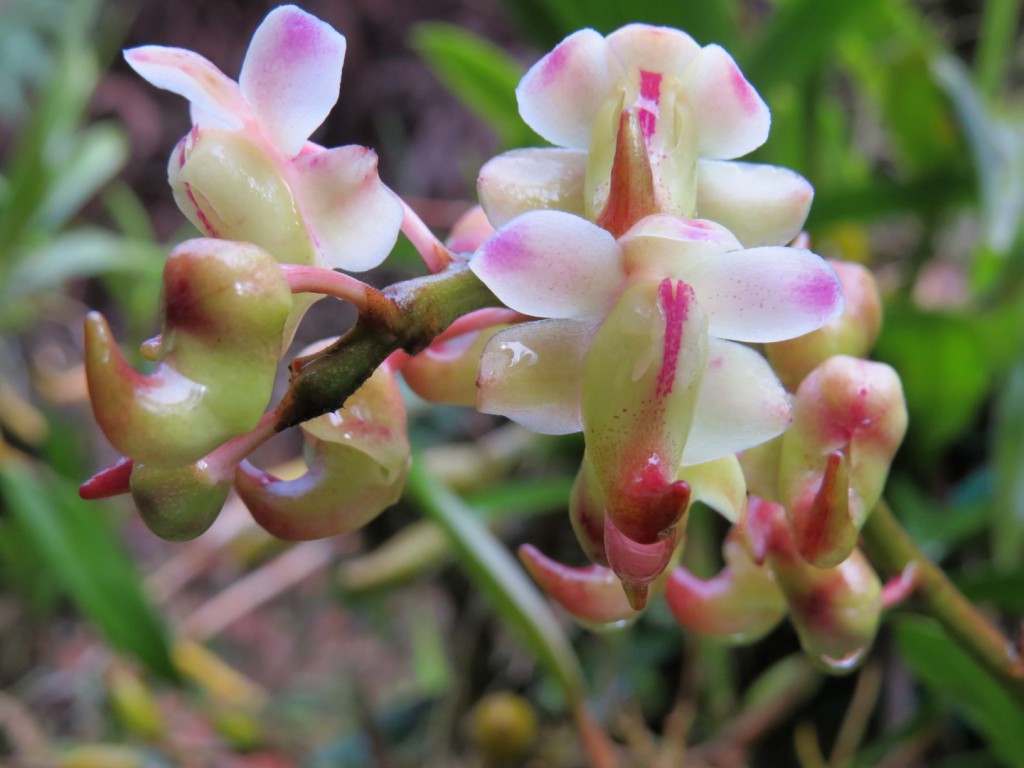
Activities include highlighting environmental problems, creating public awareness on environmental issues and conducting water and forest biodiversity studies. Dendrobium brinchangense is the orchid shown in our R.E.A.C.H. logo. It is an endangered orchid first found in Gunung Brinchang and it reflects the fragile nature of our environment. In the course of carrying out our environmental activities we have faced many obstacles but we believe there are many people out there who care. We believe there is hope yet for Cameron Highlands. It is therefore of utmost importance that we preserve our natural heritage